NCR Constituent Areas
National Capital Region (NCR) is a unique example of inter-state regional planning and development for a region with NCT-Delhi as its core. The NCR as notified covers the whole of NCT-Delhi and certain districts of Haryana, Uttar Pradesh and Rajasthan, covering an area of about 55,083 sq. kms. The sub-region wise area details are as under:
| Sub-Region | Name of the Districts | Area (in sq kms) |
|---|---|---|
| Haryana | Faridabad, Gurugram, Nuh, Rohtak, Sonepat, Rewari, Jhajjhar, Panipat, Palwal, Bhiwani,Charkhi Dadri, Mahendragarh, Jind and Karnal (Fourteen districts). | 25,327 |
| Uttar Pradesh | Meerut, Ghaziabad, Gautam Budh Nagar, Bulandshahr, Baghpat, Hapur,Shamli and Muzaffarnagar (Eight districts). | 14,826 |
| Rajasthan | Alwar and Bharatpur (Two districts). | 13,447 |
| Delhi | Whole of NCT Delhi. | 1,483 |
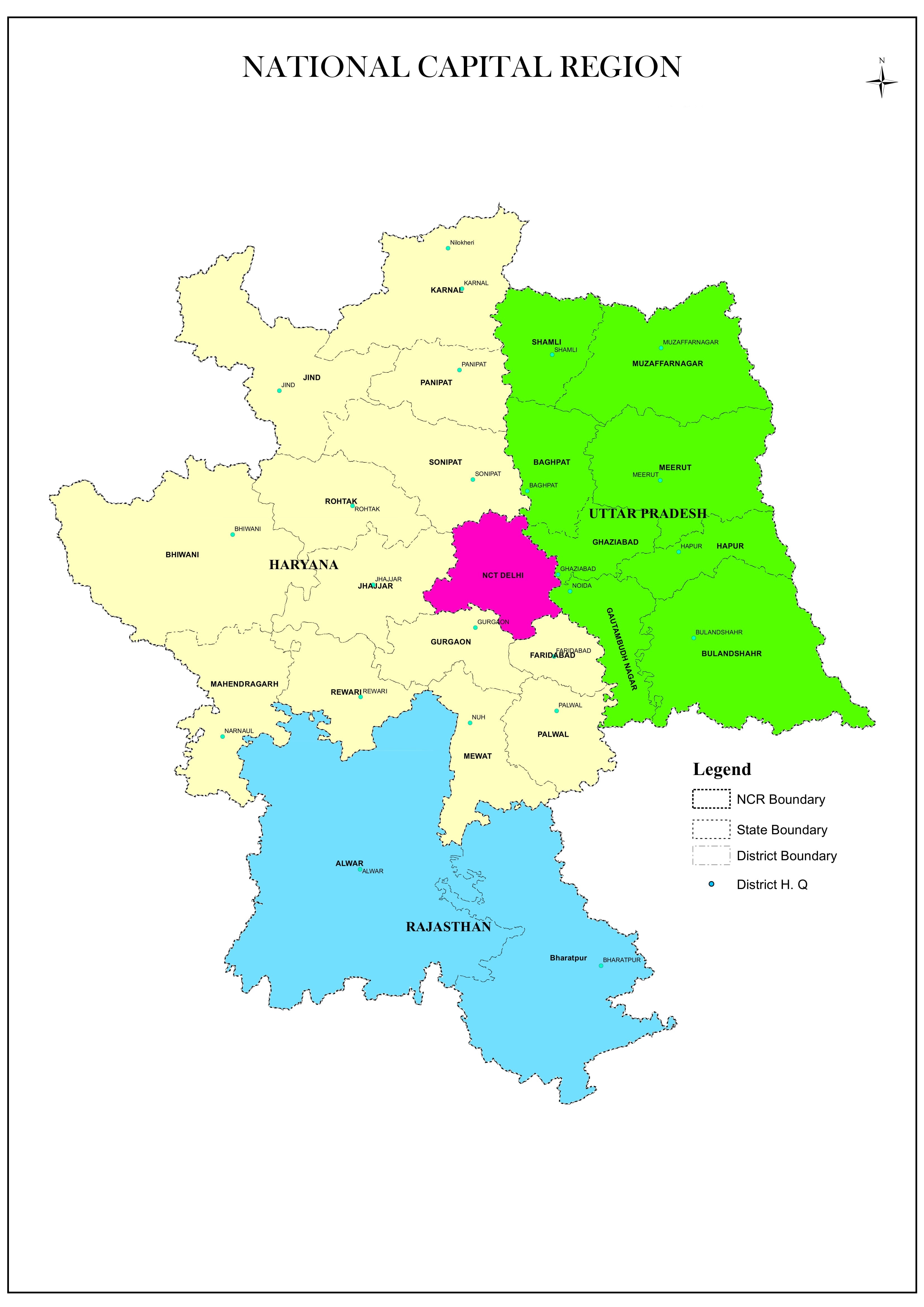
National Capital Region: Constituent Areas (as on April, 2018)
Note :Updated Map of Constituent Areas of NCR is yet to be prepared.